Tuesday, June 27, 2017

Smoky Mountains Day 2

I started today by going to the Sugarlands Visitor center in the National Park to talk with the rangers about hiking trail ideas. We discussed a couple of options and I decided on taking the Alum Cave/Mount LeConte Trail. I shared info about my hike yesterday and when I mentioned I saw some bears the ranger smiled and said "A mother bear and 3 cubs and a yearling. Right?" Yep, that's what I saw. She said that they stay in that area and are seen fairly regularly.

Today's hike had 2 destination points. The first one was Alum Cave (there is no cave there just a bluff and overhang) and on the way you go through Arch Rock. It is about 2.5 miles up the trail climbing around 1,250 feet in elevation. The first section of the trail follows along Alum Cave Creek. It is definitely one of the most beautiful and serene sections of trail I have every hiked. The upward climb is gentle and the sound of the roaring creek was soothing.

I know it is hard to truly experience being out on the trail just looking at pictures, but here they are.


The stairs going through Arch Rock


There were carved steps in some of the rocks along the trail.


A dry creek bed

As you climbed further up, it began to open some so you could take in the surrounding vistas.


Alum Cave Bluff at 4,950 feet elevation is where the majority of hikers turn around and go back down.


For the foolhearted hikers, you proceed another 2.7 miles and climb an additional 1,643 feet in elevation to the top of Mount LeCante. No body said I was smart, so off I went onward and upward.


Sections of the trail became very challenging.


Yep, this is the trail!


There were some very interesting tree roots. They grow exposed so they can absorb water directly rather than from soil.

This is the roots of a group of trees that had fallen over. Notice that the trail goes under them.


Selfie time. The tube you see goes to my camelback water pouch in the backpack. You can drink while hiking.


There was some interesting fauna along the trail.


One last push upward before reaching the summit and then the trail leveled out.


Ahhhhh! some level trail.

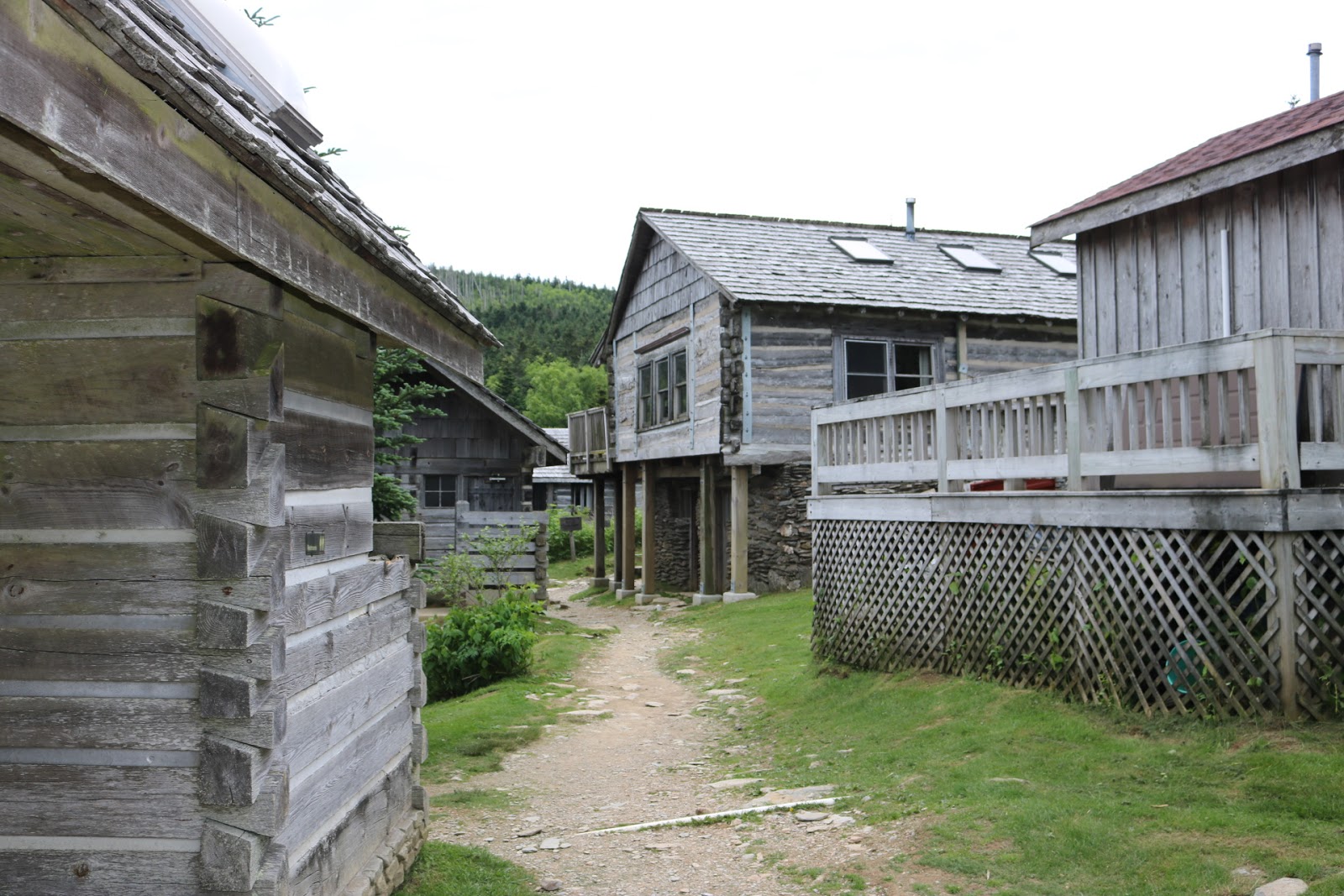
At the top is LeConte Lodge which provides the only commercial lodging in the national park. There are 10 rustic cabins. 

Info from the lodge website: Accessible only by hiking trails and set at 6,593 feet, this storied 1920s-era lodge provides panoramic views of the Great Smoky Mountains. 

The hand-built, rough-hewn log cabins (7 single-room units and 3 multi-room lodges) offer heaters, lanterns, and bunk beds with linens and Hudson Bay wool blankets. All also have washbasins (there are no showers), tables and chairs, and covered porches with rocking chairs. There's no electricity.


There is a dining hall and most importantly - restrooms to use before the hike down.

Found a nice porch swing to rest in before tackling the hike down.

Okay, the challenge level rating for this trail is HARD/STRENUOUS and I agree. It took me a little over 6 hours to make the round trip trek. My knees began to complain on the way back down but I feel that it was definitely worth the effort. 

In total I hiked 12.5 miles and climbed about 2,965 feet in elevation. I was totally exhausted at the end and was ready for some Ibuprofen and a nap. Tomorrow I will try a couple of easier trails (maybe).

Monday, June 26, 2017

Smoky Mountains Day 1

I had an opportunity to come to the Gatlinburg area for a few days to do some more mountain hiking. There is a big difference in snow hiking in the Rocky Mountains and summer hiking here in the Smoky's.

My initial plan was to hike a short (round trip of 5.5 miles) trail up to Rainbow Falls. However, the trail is being closed during week days to allow for repair due to the fire last year and subsequent storm damage. So, on to my second plan A: hike the Old Sugarlands Trail from Cherokee Orchard Road to the Newfound Gap Road (an 8 mile round trip climbing 1,350 feet in elevation -- both going and coming back). the trail head was at the same starting point for the Rainbow Falls trail.


The trail in the beginning follows an old road that led to an old CCC camp. Once past the camp area it drops down close to a river and the trail becomes narrower.

There were some beautiful sections with flowing streams.


Remains of old stone walls could be seen throughout the woods.

There were some signs of the fire but it appeared that this section was spared major damage.


The rolling mountains are very different from the sharp and jagged mountains of the west.

It looks like the bear(s) had some fun shredding this fallen tree.

A section of the old road bed.


Someone created a stone sculpture.

Time for a rest break and to enjoy the babbling stream.

The trail begins to narrow.

There were a few flowers in bloom. This looks like a phlox.

Rhododendron in bloom

Another stone wall


Along the trail I met a few other hikers. After I reached the end and began my return hike, I met a couple I had seen earlier. They told me they had seen a mother bear and her cubs and the area where they were. So as I got close to that area I began to watch closely and was rewarded with seeing them. The cubs were practicing climbing the tree. The mother bear watched me as I watched them for a while. I began clanging some rocks together and shouting to encourage them to move on so I could continue my hike back.

There were 3 cubs (2 on the tree and one behind the mother)


After that encounter I continued my heightened watch and about a 1/2 mile further up the trail I came across another bear standing on the trail. I snapped this picture and he stood and looked at me. I put down my camera and took a few steps backwards to let him know I wasn't a threat. It took about 15 minutes before my yelling, clapping hands, clanging rocks, and waiting before he decided to go into the woods and let me pass.

After my longer than planned hike I decided to head back to town. On the way back was a pull off for the Noah "Bud" Ogle Farm. There is the old log home and barn, and a nature trail through the forest down to a creek.


Down by the creek was an old "tub" mill with a water sluice.


The nature trail was challenging at times with climbing over rocks and watching for tree roots but offered some beautiful scenery.

Beautiful mountain ferns.


I came across some very unique "wildlife" playing in the creek.

Some of the challenging sections of the trail.


Rhododendron 


Time for a selfie!

So, my planned short hiking day turned out to have 11.4 miles of up, up, up, and down (and then back) trails. I am tired, but it was a great day to be out among nature.

NOTE TO SELF: DON'T forget the bug spray. It was a little annoying being the mosquito buffet at times.